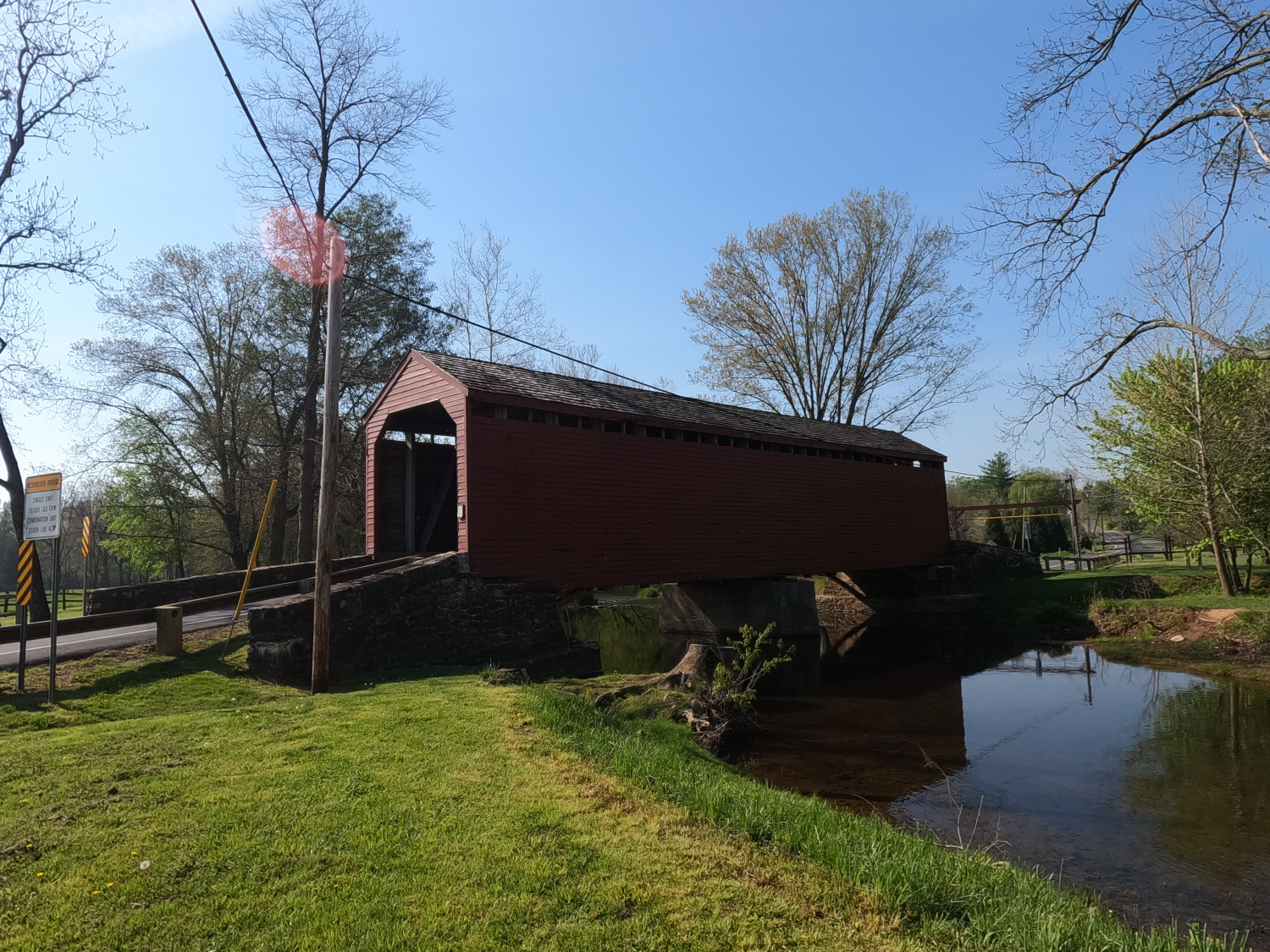
Loys Station Covered Bridge
NBI Information
Location
State: Maryland
County: Frederick County
Feature Carried: Old Frederick Road
Feature Crossed: Owen’s Creek
Latitude, Longitude: 39.6087, -77.3514
Toll: On free road
Maintenance Responsibility: County Highway Agency
Structure Open, Posted, or Closed to Traffic: Posted for load (may include other restrictions such as temporary bridges which are load posted)
History
Year Built: 1869
Historical Significance: Bridge is on the National Register of Historic Places.
Year Reconstructed: 1994
Picture Date: April 26, 2026
Geometry
Lanes on Structure: 1
Lanes under Structure: 0
Skew: 0 degrees
Number of Main Spans: 2
Main Structure Type: Truss - Thru
Main Structure Material: Wood or Timber
Number of Approach Spans: 0
Approach Structure Type: None
Approach Structure Material: None
Condition
Inspection Date: October 2023
Deck Condition: Satisfactory
Superstructure Condition: Satisfactory
Substructure Condition: Satisfactory
Channel Condition: Satisfactory
Culvert: Not Applicable
NBI Year: 2025
Bridge Information
The Loys Station Covered Bridge was built in the 1860s using a multiple kingpost truss design. It is set on two random-coursed stone abutments which have been partially encased in concrete.
In 1930, the bridge was reinforced with steel beams, and a central pier was added to improve stability.
The bridge was burned by arsonists in 1991 as part of an insurance fraud scheme. It was reconstructed using five of the original beams along with new king posts and knee braces. It was reopened three years later.
The bridge was also struck by vehicles and damaged twice in 2013 but was quickly restored both times. It was rehabilitated in 2015. This project included installing interior fire retardant, repainting the exterior and adding a fire alarm system. Low clearance warning bars have since been added on either side of the bridge to prevent oversize trucks from accessing it.
References