Brown Covered Bridge
NBI Information
Location
State: Vermont
County: Rutland County
Feature Carried: Upper Cold River Road (C3006)
Feature Crossed: Cold River
Latitude, Longitude: 43.5663,-72.9189
Toll: On free road
Maintenance Responsibility: Town or Township Highway Agency
Structure Open, Posted, or Closed to Traffic: Posted for load (may include other restrictions such as temporary bridges which are load posted)
History
Year Built: 1880
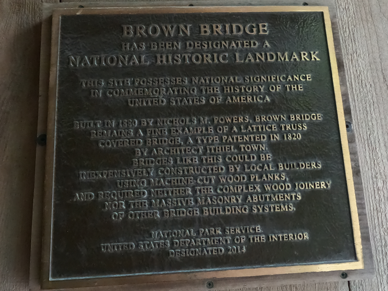
Historical Significance: Bridge is on the National Register of Historic Places.
Year Reconstructed: 2015
Picture Date: July 12, 2026
Geometry
Lanes on Structure: 1
Lanes under Structure: 0
Skew: 0 degrees
Number of Main Spans: 1
Main Structure Type: Truss - Thru
Main Structure Material: Wood or Timber
Number of Approach Spans: None
Approach Structure Type: None
Approach Structure Material: None
Condition
Inspection Date: October 2024
Deck Condition: Very Good
Superstructure Condition: Satisfactory
Substructure Condition: Very Good
Channel Condition: Good
Culvert: Not Applicable
NBI Year: 2025
Bridge Information
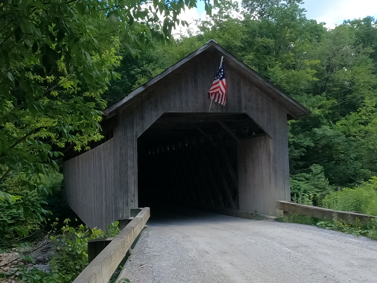
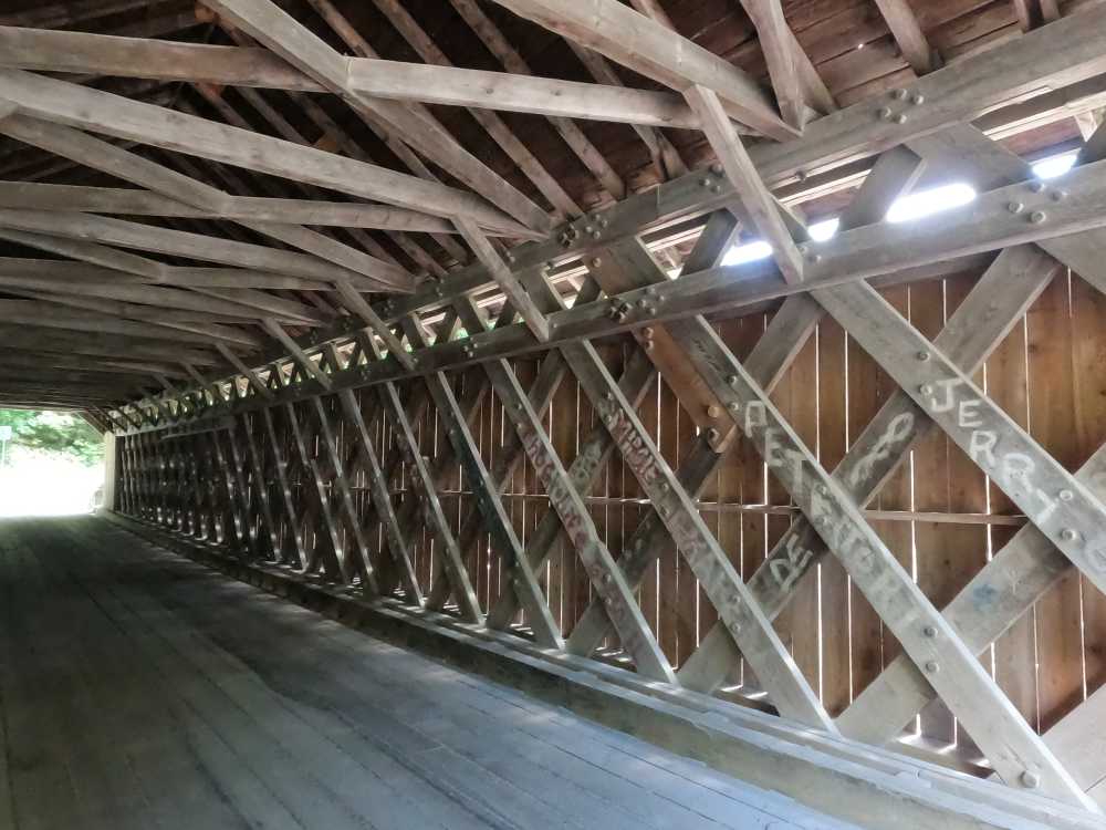
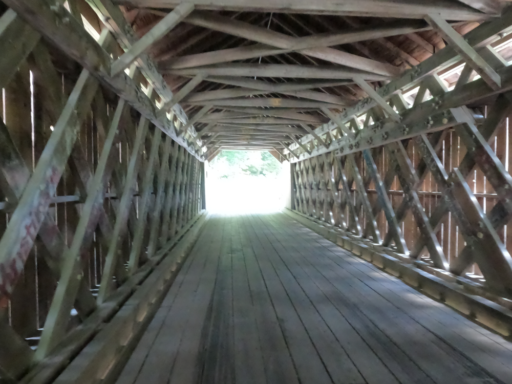
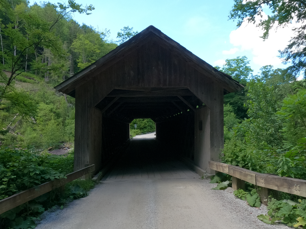
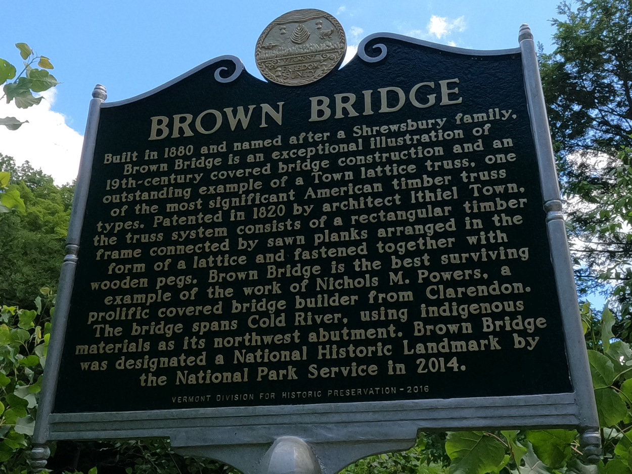
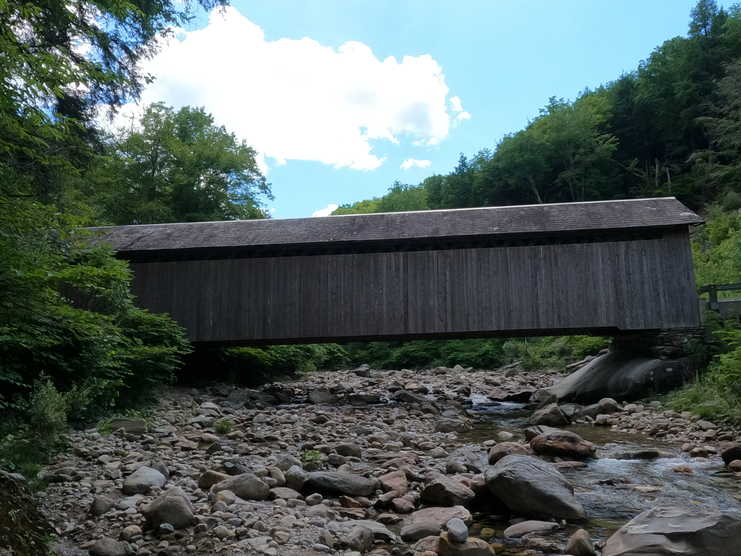
The Brown Covered Bridge is a Town lattice truss covered bridge which was built in 1880. It is one of the best-preserved covered bridges nationwide and is one of the only remaining bridges to have a slate roof.
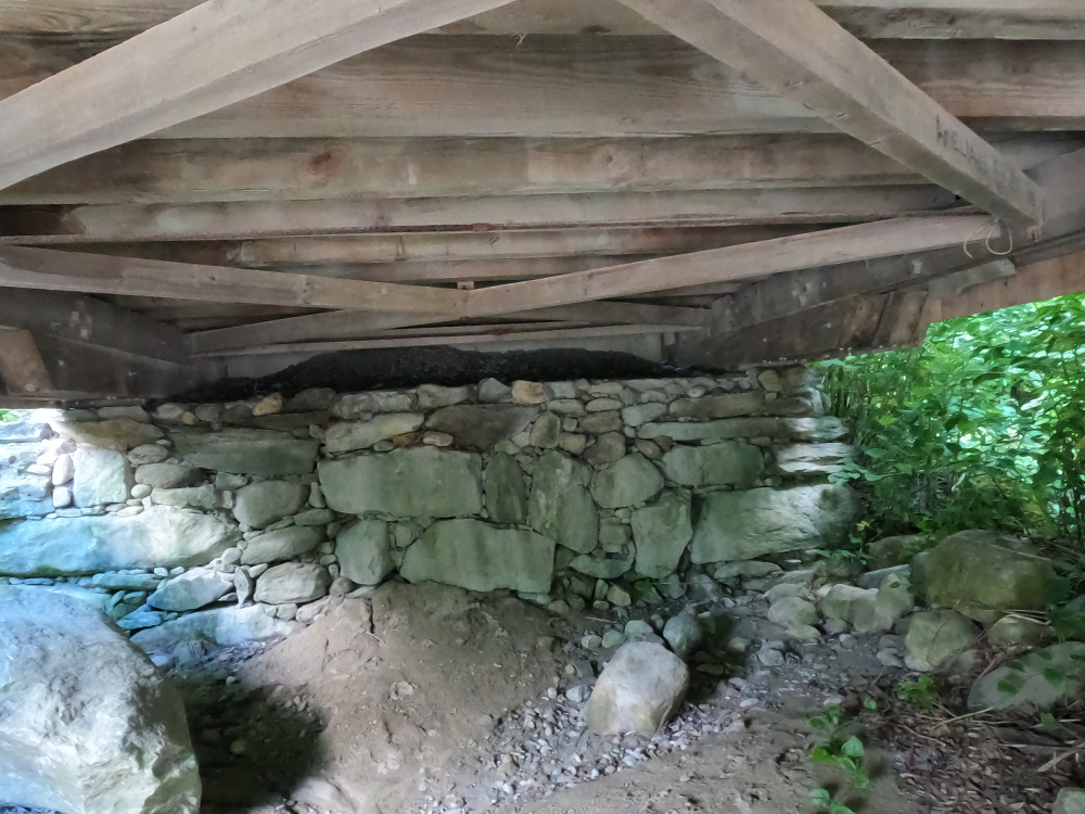
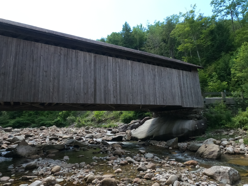
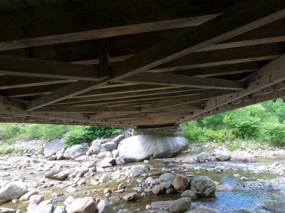
The bridge sits on irregular dry-laid stone abutments, with the north abutment sitting on an extremely large boulder. The walls are sheathed in vertical weatherboard siding, and iron tie-rods extend between the bottom chords to provide reinforcement.
The bridge was closed to traffic in 2011 after it was damaged by Hurricane Irene. It was repaired and reopened on July 5, 2016. These repairs consisted of sistering the damaged lattice members, replacing the siding, repairing the slate roof, repairing the foundation, and rebuilding the approaches.
References
Bergeron, Steve. “BrownBridge.” Covered Bridges on Two Wheels, https://vermontfatboy.wixsite.com/bridgesonwheels/brown-bridge. Accessed 27 Aug. 2026.
“Brown Bridge.” The Historical Marker Database, https://www.hmdb.org/m.asp?m=97286. Accessed 27 Aug. 2026.
Henry, Hugh. "National Register of Historic Places Nomination Form: Brown Covered Bridge." United States Department of the Interior/National Park Service. October 1, 1973. Accessed August 27, 2026. https://npgallery.nps.gov/NRHP/GetAsset/bc617075-5d22-4f44-9fa3-4566b4a8d77a