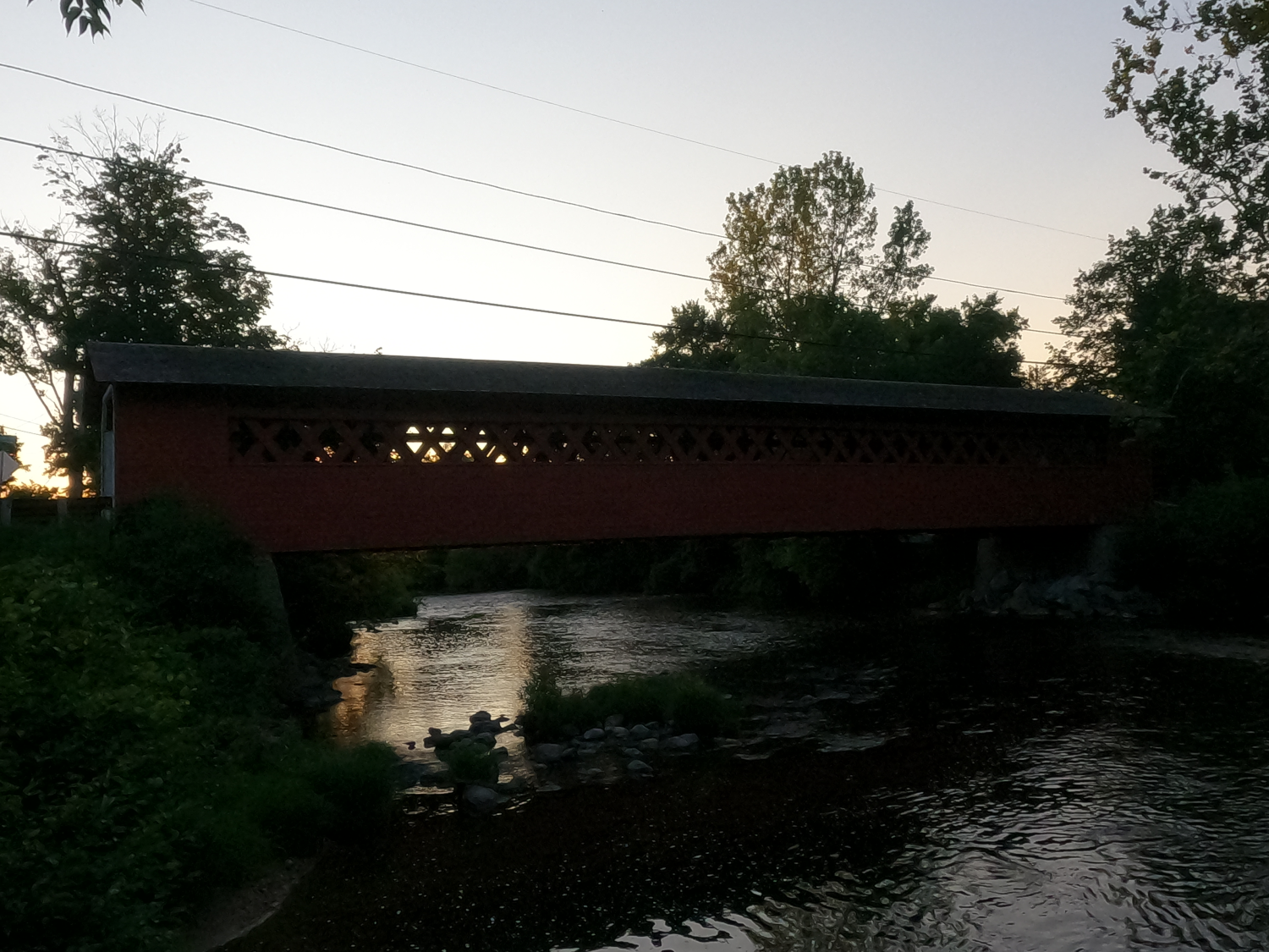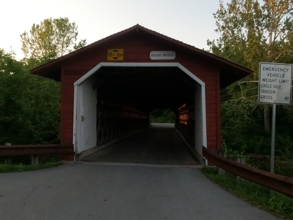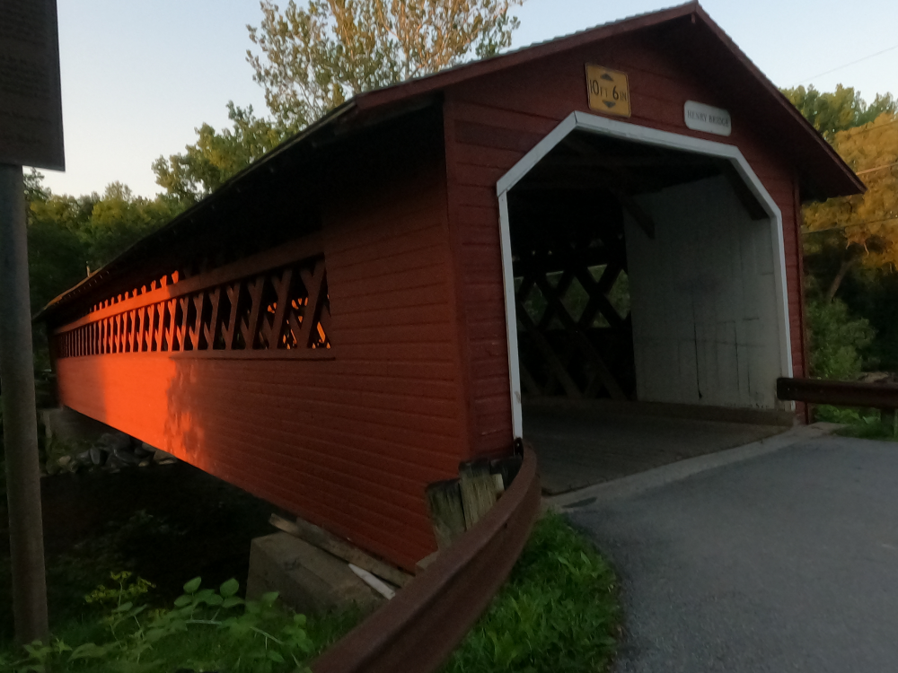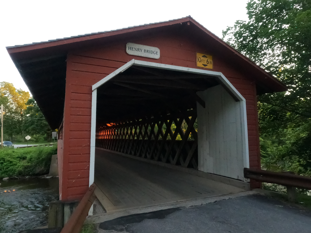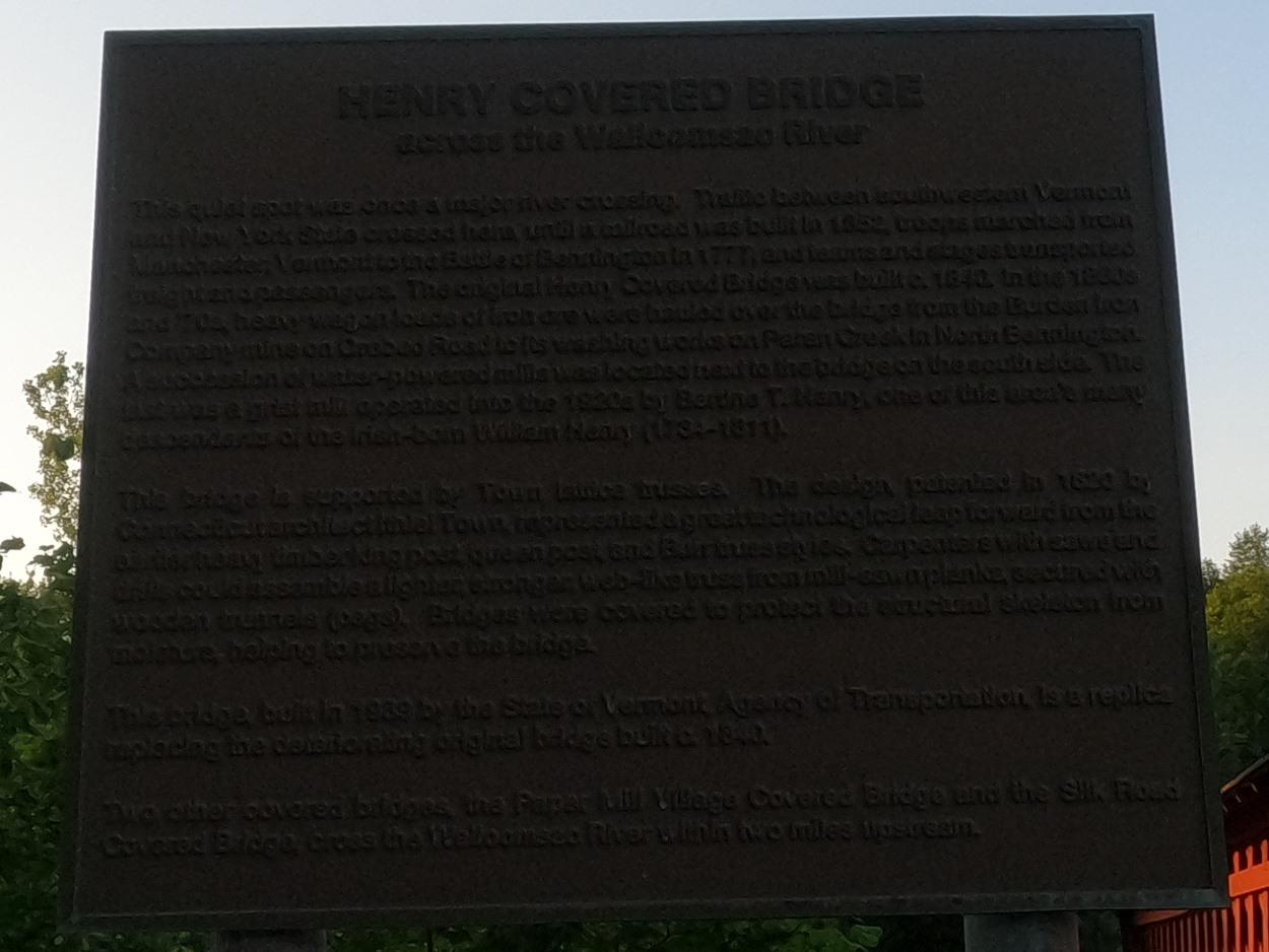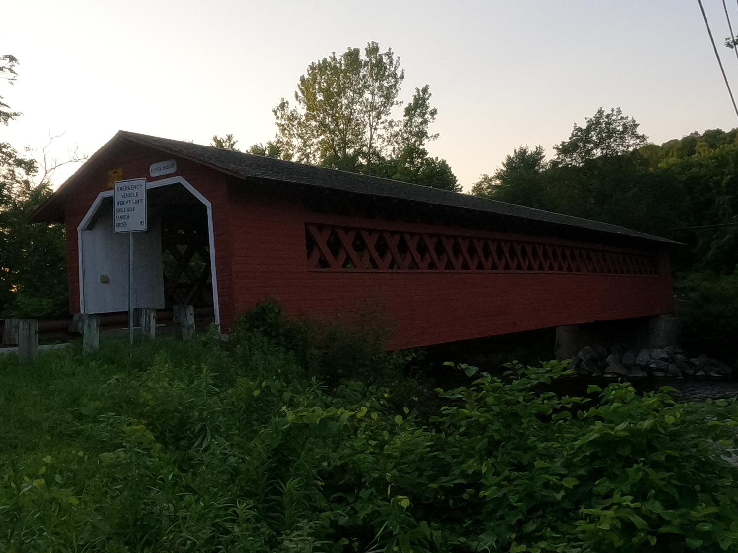
Henry Covered Bridge
NBI Information
Location
State: Vermont
County: Bennington County
Feature Carried: River Road (C3008)
Feature Crossed: Walloomsac River
Latitude, Longitude: 42.9125,-73.2546
Toll: On free road
Maintenance Responsibility: Town or Township Highway Agency
Structure Open, Posted, or Closed to Traffic: Posted for load (may include other restrictions such as temporary bridges which are load posted)
History
Year Built: 1840
Historical Significance: Bridge is not eligible for the National Register of Historic Places.
Year Reconstructed: 1989
Picture Date: July 4, 2025
Geometry
Lanes on Structure: 1
Lanes under Structure: 0
Skew: 0 degrees
Number of Main Spans: 1
Main Structure Type: Truss - Thru
Main Structure Material: Wood or Timber
Number of Approach Spans: None
Approach Structure Type: None
Approach Structure Material: None
Condition
Inspection Date: November 2023
Deck Condition: Satisfactory
Superstructure Condition: Satisfactory
Substructure Condition: Good
Channel Condition: Very Good
Culvert: Not Applicable
NBI Year: 2024
Bridge Information
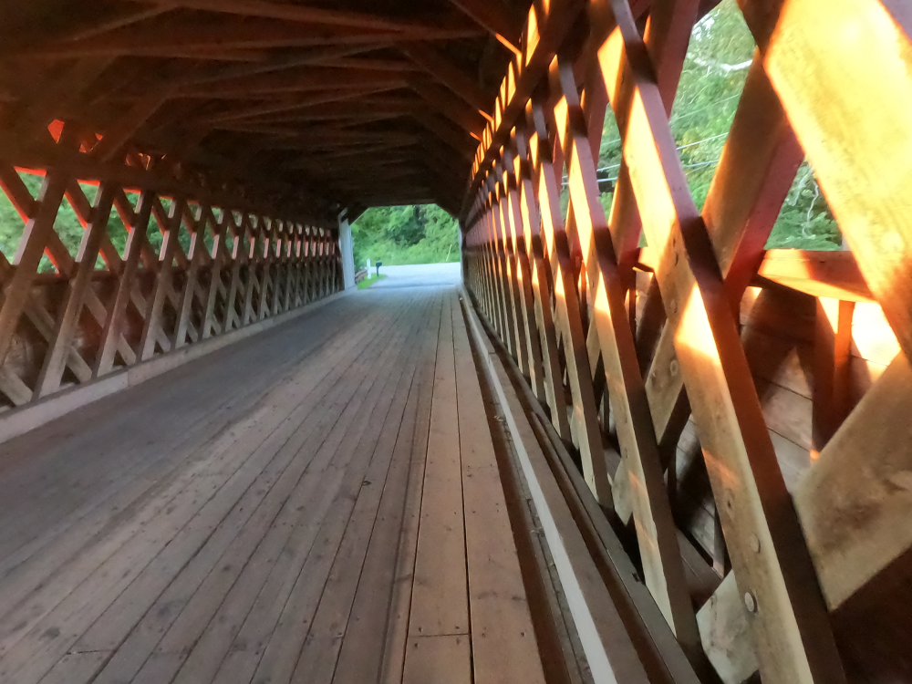
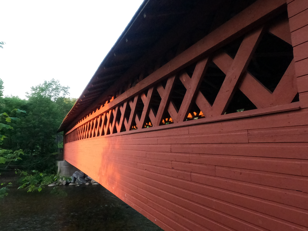
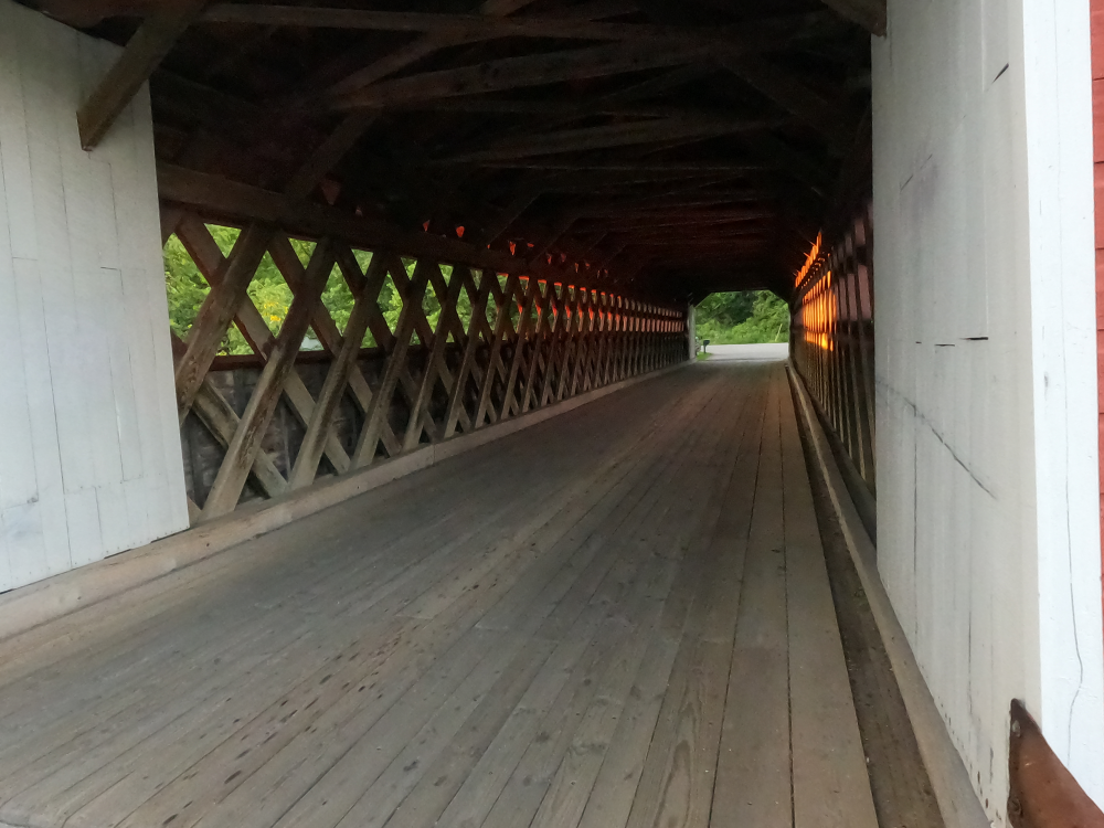
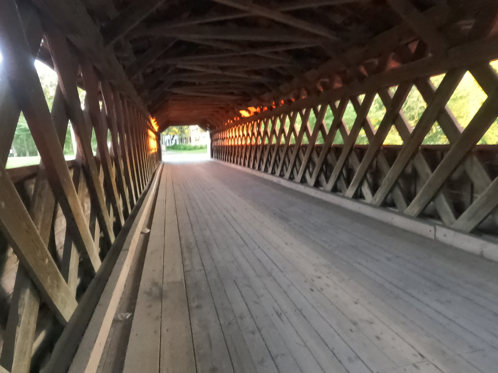
The Henry Covered Bridge is a Town lattice truss that was built sometime between 1830 and 1840. This was a common design at that time and there are numerous similar bridges throughout the area. The sides of these bridges were clad in vertical boards, as were the insides of the portals.
Circa 1866 an attempt was made to strengthen the bridge to allow it to carry the heavy wagon loads or iron ore that was mined in the area. Two layers of lattice trusses were added to the original truss. However, this was ultimately deemed ineffective, and the trusses were removed in 1952. At some point, diagonal iron sway braces were added to the underside of the floor for reinforcement, and the abutments were rebuilt in concrete.
The bridge was completely rebuilt in 1989 following the original specifications.
References