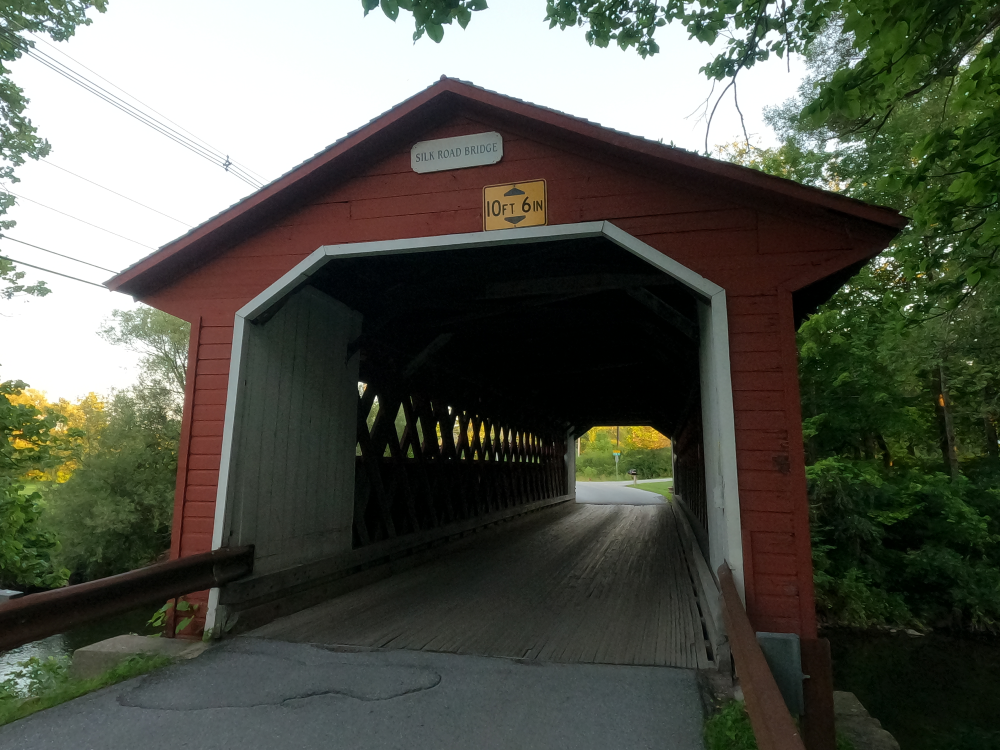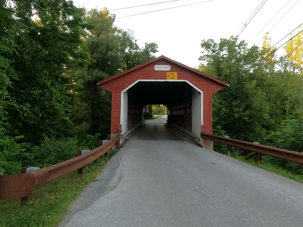
Silk Road Covered Bridge
NBI Information
Location
State: Vermont
County: Bennington County
Feature Carried: Silk Road (C3026)
Feature Crossed: Walloomsac River
Latitude, Longitude: 42.9094,-73.2254
Toll: On free road
Maintenance Responsibility: Town or Township Highway Agency
Structure Open, Posted, or Closed to Traffic: Posted for load (may include other restrictions such as temporary bridges which are load posted)
History
Year Built: 1840
Historical Significance: Bridge is not eligible for the National Register of Historic Places.
Year Reconstructed: 1991
Picture Date: July 4, 2025
Geometry
Lanes on Structure: 1
Lanes under Structure: 0
Skew: 0 degrees
Number of Main Spans: 1
Main Structure Type: Truss - Thru
Main Structure Material: Wood or Timber
Number of Approach Spans: None
Approach Structure Type: None
Approach Structure Material: None
Condition
Inspection Date: October 2023
Deck Condition: Satisfactory
Superstructure Condition: Satisfactory
Substructure Condition: Fair
Channel Condition: Good
Culvert: Not Applicable
NBI Year: 2024
Bridge Information
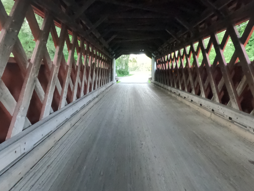
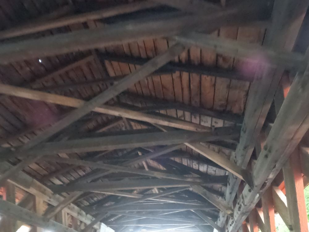
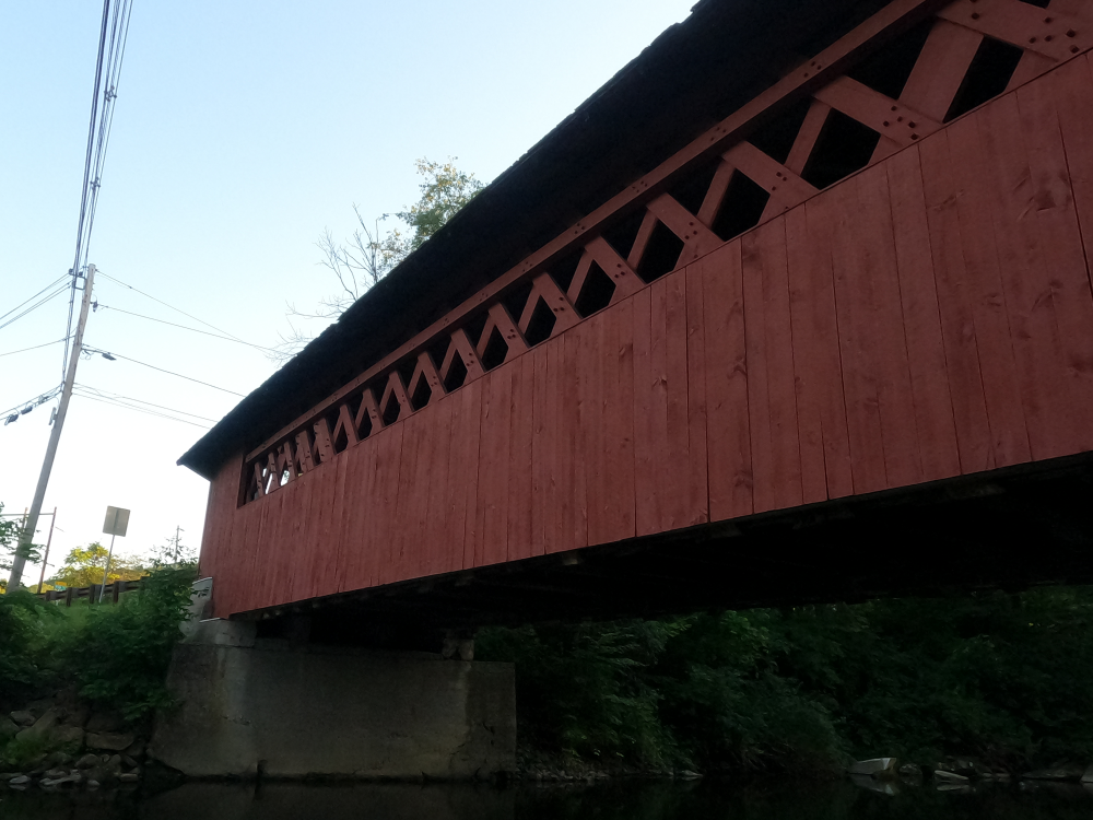
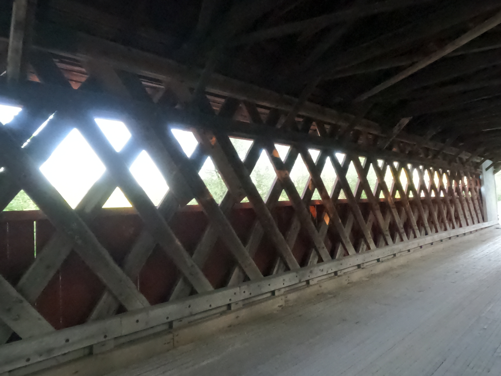
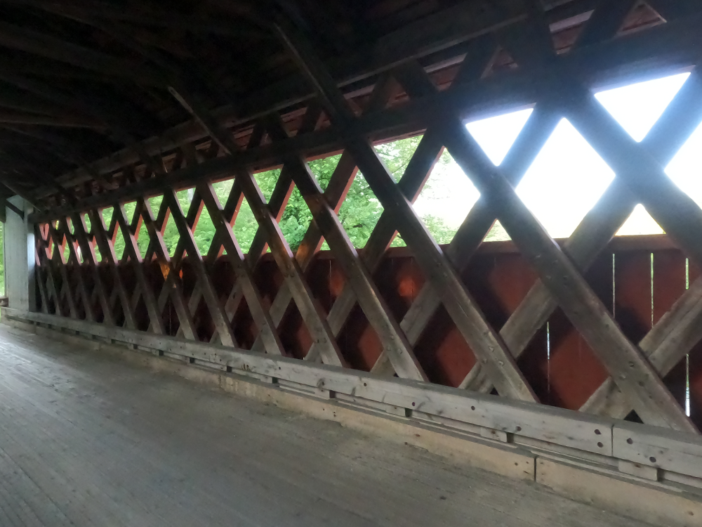
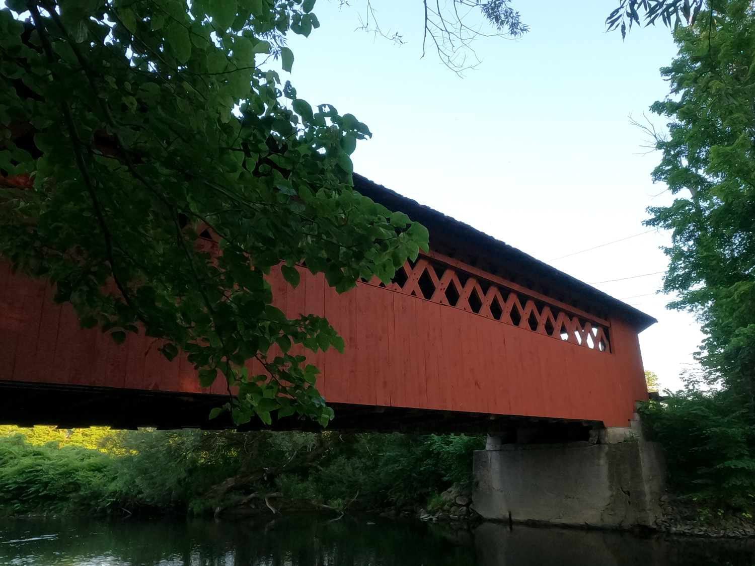
The Silk Road Covered Bridge was built in 1840 and is a Town lattice truss. This was a common design at that time and there are numerous similar bridges throughout the area. The sides of these bridges were clad in vertical boards, as were the insides of the portals.
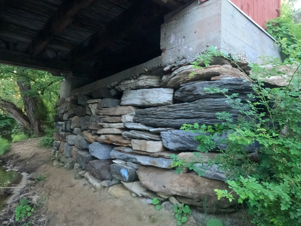
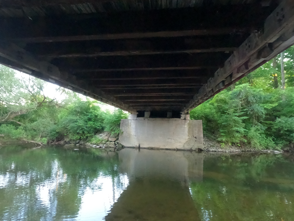
This bridge is the oldest covered bridge in Bennington County. The north abutment is the original stone, although it has been faced with concrete. The south abutment is a reconstructed stone structure. At some point additional floor beams were added to the structure for reinforcement.
In 1986 the bridge was deemed unsafe due to numerous vehicle accidents and an arson attempt. The bridge was weight posted at this time, and the speed limit was lowered. The bridge underwent restoration in 1991, when the rotted wood was replaced. The bridge was damaged by flooding caused by Hurricane Irene on August 28, 2011, and it was repaired and reopened.
References